
The Okavango Delta Flood Cycle
Where the water comes from, the four-to-five-month lag between rain and flood, and why forecasting the peak is genuinely uncertain.
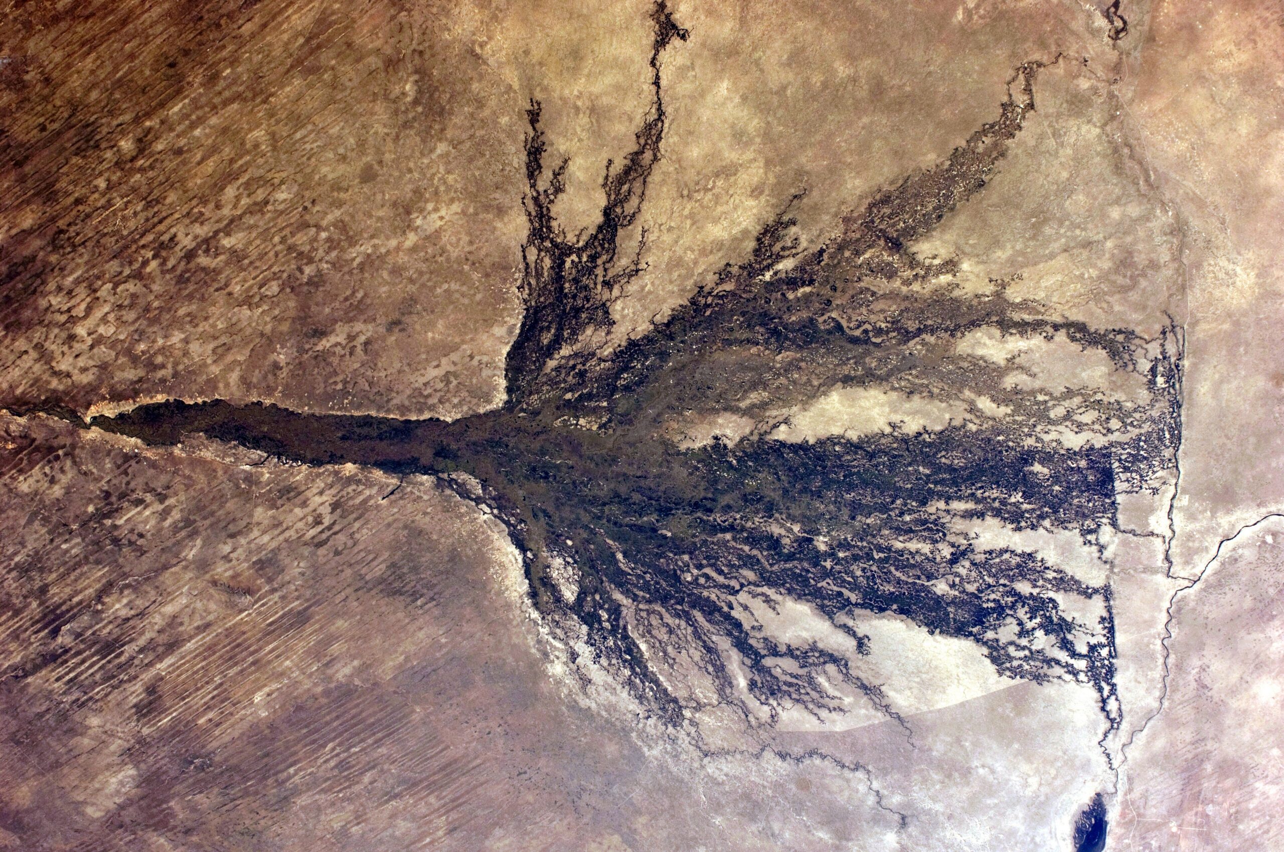
Wildlife & seasonsThe Okavango Delta regionThe Okavango Delta photographed from the International Space Station, showing the fan of channels and floodplain. Photo: ISS Expedition 28 crew, Public domain, via Wikimedia Commons.
The single most counter-intuitive fact in Botswana travel is that the Okavango Delta flood peaks in the dry season. The water spreading across the Delta in the middle of a rainless southern winter fell on the Angolan highlands months earlier and a country away. This page covers where the water comes from, how long it takes, what the published hydrology says about the timing, and what that means for when to travel.
At a glance
- The flood arrives in the dry season. UNESCO’s World Heritage inscription cites this reversed cycle explicitly as a reason the Delta was listed.
- The water is Angolan, falling on the highlands roughly October to April and travelling some 1,500 km to enter Botswana at Mohembo.
- Inlet peak around March–April, with flow rising seasonally from roughly 100 m³/s to over 600 m³/s.
- Maximum inundation in the distal Delta around August–September, a lag of four to five months. Water typically reaches the Boro and Maun by about mid-June.
- Flooded area varies enormously, from roughly 4,000–6,000 km² at minimum to about 6,000–12,000 km² at maximum.
- Local rain is not the driver. Rainfall over the Delta averages 475 mm and has only expanded flood extent when annual rainfall exceeded 700 mm — three times in thirty years.
- It is not really a delta but a low-gradient alluvial fan in an endorheic basin, with no outlet to the sea.
- Forecasting is genuinely uncertain — a leading Okavango hydrologist: “no flood was the same as the other.”
In this guide
- Why the Okavango Delta flood runs backwards
- Where the water comes from
- The lag, with the actual figures
- Scale, and why local rain is not the driver
- Not a delta: an alluvial fan with no outlet
- Why the flood pulse matters
- What it means month by month
- The essential caveat
- One claim we do not repeat
Why the Okavango Delta flood runs backwards
Botswana’s rain falls in summer, roughly November to March. In most wetlands that would also be the high-water season. In the Okavango it is not. UNESCO’s inscription states it plainly: the annual flooding from the River Okavango occurs during the dry season, with the result that native plants and animals have synchronised their biological cycles with these seasonal rains and floods. That inversion is one of the explicit reasons the Delta became the 1,000th site on the World Heritage List in 2014, inscribed under criteria (vii), (ix) and (x) across 2,023,590 ha with a 2,286,630 ha buffer zone. It has also been a Ramsar wetland since 1996.
The practical consequence is that the two things which most affect a Delta trip — water and game concentration — peak together in midwinter, and the wettest-looking landscape of the year occurs when it has not rained for months.
Where the water comes from
The Okavango rises in the Angolan highlands and flows roughly 1,500 km through Angola and along the Namibian Caprivi before entering Botswana at Mohembo, at the top of the panhandle above Shakawe. From there it spreads south and east across the sand.
UNESCO notes that the sources in Angola and Namibia remain unaffected by upstream dams or significant water abstraction — a material point for the Delta’s long-term future, and one of the few large river systems of which it can still be said.
The lag, with the actual figures
Rain falls on the Angolan catchment during the southern African summer, roughly October to April, then takes months to travel down the catchment and spread through the fan. Our sources agree on the shape of this and differ on the detail, so we give both rather than average them.
At Mohembo, the inlet:
- One peer-reviewed study gives peak discharge in April, with flow rising seasonally from roughly 100 m³/s to over 600 m³/s.
- A second peer-reviewed source gives the peak as March/April.
- Botswana’s own Department of Water Affairs reports inlet flood peaks occurring between March and June, with measured annual inflows of 8,536 Mm³ in 2005, 7,720 Mm³ in 2006 and 10,297 Mm³ in 2007 — which gives some sense of how much the years differ.
In the lower or distal Delta:
- Maximum flood extent is recorded in August/September, a lag of four to five months behind the inlet peak. The delay is attributed partly to the distance of the headwaters from the Delta and partly to the slow propagation of the flood within the Delta itself.
- A second study puts maximum inundation across May to September, with the minimum November to March, and the flood pulse taking up to six months to reach the distal ends of the system. It notes explicitly that the November–March rainfall period is out of phase with flooding.
- Botswana government reporting has floods typically reaching the Boro and Maun by mid-June, which is the most useful single anchor for the southern Delta.
Stated conservatively: water enters at the panhandle around March to May and reaches the far southern and eastern reaches around June to September. Where you are in the Delta therefore determines what you see and when. The panhandle and permanent swamp are wet all year; the seasonal floodplains may only flood in midwinter, or in a poor year not at all.
Scale, and why local rain is not the driver
Flooded area varies from a minimum of about 4,000–6,000 km² to a maximum of about 6,000–12,000 km², driven by variation in upstream discharge. Total annual water storage is on the order of 10 km³. UNESCO gives the composition as roughly 600,000 ha of permanent swamp plus up to 1.2 million ha of seasonally flooded grassland.
Rainfall over the Delta itself averages 475 mm a year and contributes somewhere between 5% and 42% of total water input, the remainder arriving from the Angolan highlands. But contributing water is not the same as driving flood extent, and this is where a good deal of travel writing goes wrong. Local rainfall generally does not cause the flood to expand: in the published record it did so only when annual rainfall exceeded 700 mm, which happened three times in thirty years. Otherwise local rain influences maximum extent only through its interaction with inflow and how wet the ground already was.
A wet summer in Maun therefore tells you little about how far the flood will spread. What matters is what fell in Angola.
Not a delta: an alluvial fan with no outlet
Strictly, the Okavango is not a river delta at all. A delta discharges into a sea or lake; this system discharges into nothing. It is a large, very low-gradient alluvial fan in an endorheic — internally draining — basin, and the peer-reviewed hydrology describes it as exactly that. Water arrives, spreads across an area the size of a small country, and leaves by evaporation, transpiration and groundwater rather than by flowing onward.
That geometry is also why the flood moves so slowly. With almost no gradient to push it, the pulse creeps outward through papyrus, reed and floodplain, losing water as it goes, until it stops wherever that year’s volume runs out.
Why the flood pulse matters
The flood pulse drives the entire system. Inundation triggers boom conditions in primary production and zooplankton, creating nursery habitat for fish; the dry season then concentrates fish back into the channels, which in turn concentrates everything that eats them. The Delta supports large mammal biomass averaging around 12 t/km².
It also explains distribution. Red lechwe, the signature Delta antelope, are adapted to running through shallow water and shift range through the year as the flood advances and recedes. Sitatunga belong to the permanent papyrus of the panhandle rather than the seasonal floodplain, which is why they are so rarely seen from a vehicle. More in our wildlife section.
What it means month by month
This is a general pattern rather than a forecast, and where you are in the Delta matters as much as when you go.
- March–May. Inlet peak at Mohembo. The panhandle is high; the southern and eastern Delta is still catching up. Rain is tailing off and tracks are recovering.
- June–August. The flood reaches the Boro and Maun around mid-June and the seasonal floodplains fill through the winter. This is when mokoro is most likely to be possible at camps that depend on seasonal water, when the eastern floodplains are wet, and when game concentrates on permanent water. It is also when Delta tracks flood — water across a road here has nothing to do with rain.
- August–September. Maximum inundation in the distal Delta on the published record, coinciding with peak dry-season game viewing.
- October–November. Water receding, heat building, surface water at its scarcest away from the flood: concentrated game viewing in demanding conditions.
- December–March. Minimum inundation in the distal Delta, and simultaneously the local rainy season — green, dispersed game, migrant birds, and the tracks at their worst.
Mokoro is water-dependent, not guaranteed. Camps in the permanent swamp can offer it year-round; camps at the seasonal margins cannot, and the same camp can have water one year and none the next. Ask the camp directly about current water levels rather than relying on a brochure month range. See our Okavango Delta guide and accommodation pages.
The essential caveat
Dr Mike Murray-Hudson of the Okavango Research Institute, one of the authors of the core hydrological work on the Delta, is quoted in Botswana government media saying simply that “no flood was the same as the other”.
That is the honest position, and it should temper every month-by-month table on the internet, including ours. Treat any current-season claim — a “high-water year”, an “early flood” — with the scepticism you would apply to a long-range weather forecast, and prefer Department of Water Affairs or Okavango Research Institute data to operator blogs, which typically rest on staff observation rather than measurement. Water levels also affect road access into Moremi, so if you are driving, check route status — our self-drive pages cover that.
One claim we do not repeat
You will very often read that “95%” or “98%” of the Delta’s water evaporates. It is plausible in principle for an endorheic system, and may well be broadly right. But we could not confirm any specific figure from a primary hydrological source — neither the Department of Water Affairs report nor the peer-reviewed hydrology we consulted gives an evaporation-loss percentage — so we do not publish one. What can be said accurately is that the system has no outlet to the sea and loses its water to evaporation, transpiration and groundwater rather than onward flow.
Where to stay when the water is up
Water camps and island lodges inside the concessions, each written up on our own page.
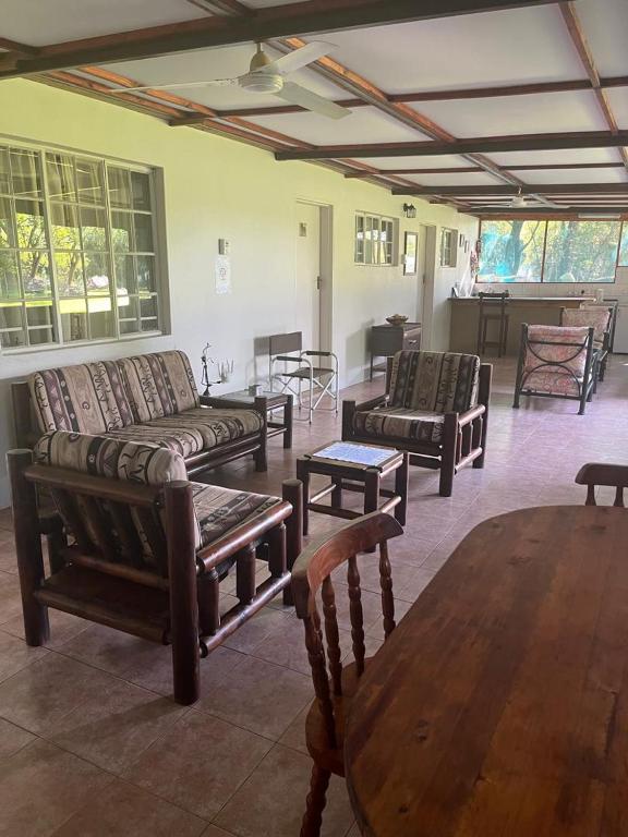



View all 7 Okavango Delta propertiesAll Okavango Delta accommodation
Every card opens our own property page first. We publish no rates, no availability and no ratings of our own.
Getting onto the water
Poled mokoro trips on the Delta fringe, bookable for a fixed date.
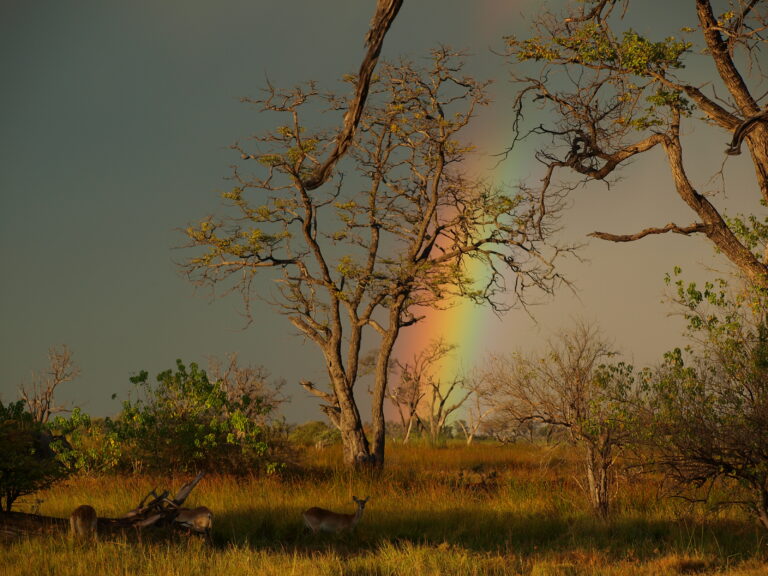
Every card opens our own tour page first. Booking happens on the operator’s site, where the live price and availability are.
Plan the rest of your trip
- Okavango Delta — Maun, the camps and how the Delta is reached.
- Parks and reserves and Moremi.
- Mokoro safaris — the activity the flood decides, and when each part of the Delta has water to pole on.
- Shakawe and accommodation in Shakawe — the Panhandle sees the flood months before Maun does.
- Wildlife — what the flood pulse means for what you see.
- Self-drive — flooded tracks are a separate problem from rain.
- Kalahari and Chobe and Kasane — regions on different seasonal calendars.
- Travel planning, itineraries and accommodation.
Sources and references
- UNESCO World Heritage Centre — Okavango Delta (1432)
- Ramsar Sites Information Service — Okavango Delta System
- Botswana Department of Water Affairs — Flow partitioning within the Okavango Delta
- Wolski & Murray-Hudson, Hydrology and Earth System Sciences 10:127–137 (2006)
- Frontiers in Environmental Science — the Okavango as a fluctuating floodplain system
- Botswana Daily News — arrival of the floods at Boro
- Okavango Research Institute, University of Botswana
Plan the rest of your trip
The flood is the single fact that most changes when you should go, and where.
The region the flood defines, and the town at its edge.
Open →Moremi Game ReserveWhere the water reaches, and what that closes.
Open →Travel planningThe seasonal question, taken apart month by month.
Open →The flood is the calendar.
Almost every timing decision in northern Botswana follows from it — including the ones brochures get wrong.
Wildlife & seasonsAll destinations