

Gaborone & South-East Botswana
The arrival region — the capital, four working towns, three border posts and the road west into the Kalahari.
Gaborone city guideAll regionsA minibus on the tar road at the outskirts of Kanye in south-east Botswana, where the road is cut through rock, photographed in August 2018. Photo: Gonna Elvis Monngakgotla, CC BY-SA 4.0, via Wikimedia Commons.
South-East Botswana is the corner of the country that most Batswana live in and most visitors drive through. It holds the capital, the three busiest border posts with South Africa, the head of the Trans-Kalahari corridor and four of the largest traditional villages in the country. What it does not hold is big game, and being honest about that is the fastest way to work out whether the region belongs in your trip.
- Where
- The south-eastern corner, against the South African border
- Principal city
- Gaborone, the capital and main air gateway
- Main towns and villages
- Lobatse, Kanye, Molepolole, Jwaneng
- Border posts
- Tlokweng, Pioneer Gate, Ramatlabama
- Corridors
- A1 north to Francistown; A2 west to Namibia
- Best for
- Arrival and departure, history and culture, the road into the Kalahari
- Vehicle
- Tar throughout; 4×4 only beyond the region
In this guide
- What South-East Botswana actually is
- Who South-East Botswana suits
- Gaborone: the region’s gateway
- Lobatse
- Kanye
- Molepolole and the Kweneng
- Jwaneng and the road west
- The three South African crossings
- Heritage across the region
- Reserves in and beyond the region
- Driving in South-East Botswana
- Best time to visit
What South-East Botswana actually is
Geographically South-East Botswana is the smallest and most densely settled part of the country: a wedge of hills, rolling grassland and cultivated land pressed against the South African border, quite unlike the sand and pan country that fills the rest of Botswana.
Functionally it is a corridor. Two national routes begin here. The A1 runs north through Lobatse and Gaborone towards Francistown and eventually Zimbabwe. The A2, the Trans-Kalahari Highway, leaves at Pioneer Gate and runs west through Kanye and Jwaneng to Namibia. Three border posts feed both. Almost everything in South-East Botswana sits on one of those lines.
That is why the region reads differently from every other region on this site. The Okavango and Chobe are destinations. The Kalahari is a commitment. South-East Botswana is a place you arrive in, resupply in, and pass through — and it rewards travellers who understand that before they arrive rather than after.
Who South-East Botswana suits
The honest starting point: most safari travellers never come here. Intercontinental flights land at Johannesburg and the standard routing continues straight to Maun or Kasane, skipping the south-east entirely. Nothing in the region competes with the Okavango or Chobe.
South-East Botswana genuinely suits:
- Business, conference and government travellers with a spare day or weekend.
- Self-drivers entering overland from Gauteng, for whom this is the first and last of Botswana.
- Travellers interested in history and culture rather than big game — missionary sites, rock art, and several of the country’s largest traditional villages.
- Kalahari-minded self-drivers using the region to outfit a trip to Khutse and the Central Kalahari.
- Anyone driving the Trans-Kalahari between South Africa and Namibia.
Treat it as a day or two either side of something else, or as a departure point — see our Botswana itineraries.
Gaborone: the region’s gateway
Gaborone is the capital, the seat of government and the country’s principal international air gateway, with about 246,000 people at the 2022 census. For this region it functions as the airport, the hospital, the supermarket and the vehicle-hire desk.
It is also the only place in South-East Botswana with a full range of accommodation, and the natural base for a day or two spent seeing the rest of the region. We cover the city itself — arrival, orientation, what to see, where to stay and onward routes — on Gaborone.
Lobatse
Lobatse lies about 70 km south of Gaborone on the A1, and it is the cattle town. Botswana Tourism describes it as the last stop for farmers trekking livestock across the Kalahari to the Botswana Meat Commission, and beef remains one of the country’s largest export earners after diamonds.
It also holds more archaeology than its working-town appearance suggests. The tourism authority records Bangwaketse stone walling on Lobatse Estates and the Seoke stone-wall settlement built around 1770, both on private land where permission is needed. Faded rock paintings of wildebeest on the Mafikeng road are attributed to Khoe herders and dated to somewhere between roughly 1000 and 1700 AD.
The Bangwaketse settled here in the late eighteenth century before moving west to Kanye. The railway arrived in 1896, as a construction camp and siding on Rhodes’s line north, and Botswana Railways still runs through the town towards Gaborone and Francistown.
Kanye
Kanye sits roughly 80 km south-west of Gaborone, and Botswana Tourism describes the drive as rolling grassland rich in trees and shrubs with vistas of agricultural land. It is the traditional capital of the Bangwaketse, who settled here in the mid-nineteenth century, and the tourism authority calls it the longest continuously occupied capital village in Botswana.
There is more to see here than anywhere else in the region outside the capital. The Gorge, near Seepapitso Secondary School, offers walks through lush vegetation with good birding, and local history records it as the refuge where the Bangwaketse hid from Mzilikazi’s Ndebele raids. The Polokwe Viewpoint about ten kilometres north is at its best at sunrise and sunset. The village kgotla holds historical buildings including structures from 1914 and the residences of past chiefs, the oldest being the London Missionary Church of 1894. At Motse Lodge there is a museum of local artefacts and a centre where traditional arts and crafts are being revived.
The kgotla is a working meeting place, not a monument. Botswana Tourism asks visitors to go first to the kgotla offices and tell officials that you wish to visit. Do that, and ask before photographing people.
Molepolole and the Kweneng
Molepolole is the traditional capital of the Bakwena and one of the largest villages in Botswana. It sits north-west of Gaborone at the edge of the Kweneng, and for travellers its significance is directional: this is the way to Khutse Game Reserve and, beyond it, the Central Kalahari. There are a handful of guesthouses here — see accommodation in Molepolole.
Neither Molepolole nor the smaller villages around it has an official tourism page, and it is worth saying plainly why. These are large working villages rather than visitor attractions. They repay a respectful stop — the kgotla, the shops, a conversation — and they do not repay being treated as an exhibit.
Jwaneng and the road west
Jwaneng lies on the A2 west of Kanye and exists because of the diamond mine beside it. For a traveller it is a fuel and supplies stop on the Trans-Kalahari run rather than a destination, and it is the last substantial town before the long empty stretch towards Ghanzi.
The A2 itself leaves the region at Pioneer Gate and runs 762 km through Kanye, Jwaneng and the Ghanzi district to Mamuno on the Namibian border, continuing towards Windhoek. It is the main Pretoria–Windhoek freight corridor and the standard overland route for anyone combining Botswana with Namibia. It is tar throughout, but reports of potholes recur, so check current conditions rather than assuming a smooth run. At the far end it delivers you to Ghanzi.
The three South African crossings
Three crossings define the traffic through South-East Botswana, and choosing the right one is a real planning decision rather than a detail.
- Tlokweng Gate (Kopfontein on the South African side), just east of Gaborone. The capital’s principal crossing, on the route to and from Zeerust and Gauteng. Published hours run from early morning to midnight.
- Pioneer Gate (Skilpadshek), near Lobatse. The eastern end of the A2 Trans-Kalahari corridor, feeding South Africa’s N4. The main freight and long-haul crossing, also open until midnight.
- Ramatlabama, 46 km south of Lobatse. The southern end of the A1, becoming the N18 towards Mahikeng.
Published border hours change and freight queues at Pioneer Gate can be long. Confirm current arrangements, and read Botswana entry requirements before you travel.
Heritage across the region
Three sites appear on Botswana Tourism’s official heritage list, all within reach of the capital and all inside South-East Botswana.
- Kolobeng — the ruins of David Livingstone’s mission among the Bakwena, west of Gaborone near Molepolole.
- Matsieng Footprints — engravings around a waterhole, a site of long-standing traditional significance.
- Manyana Rock Paintings — rock art at Manyana, south-west of the capital.
None is a World Heritage Site: Botswana has only two, Tsodilo and the Okavango Delta, both in the north-west. These are small, quiet, lightly interpreted places, worth an afternoon for the interested rather than a detour for everyone. Taken with the Kanye kgotla and the Lobatse rock art, they are the strongest argument for giving South-East Botswana a day of its own.
Reserves in and beyond the region
Mokolodi Nature Reserve, about 10 km south of Gaborone on the Lobatse road, is the region’s main wildlife attraction and the easiest bush escape from any Botswana city. It was founded in 1994 by the Mokolodi Wildlife Foundation, a private not-for-profit. Its published size is disputed: Botswana Tourism gives five square kilometres, other references around 30 km². We use the tourism authority’s figure and note the disagreement rather than picking a winner.
Khutse Game Reserve is reached from this region rather than in it, north-west beyond Molepolole, and it is the reason a Kalahari trip can start from Gaborone at all. It shares an unfenced boundary with the Central Kalahari. Both have their own pages: Khutse Game Reserve and Central Kalahari Game Reserve.
That is the region’s wildlife offer in full. It is modest, and pretending otherwise would not help anyone plan a trip to South-East Botswana.
Driving in South-East Botswana
Driving in South-East Botswana is straightforward, and it is the only region on this site of which that is true. Tar roads throughout, reliable fuel in Gaborone, Lobatse, Kanye, Jwaneng and Molepolole, and mobile coverage through the towns and along the main routes. An ordinary car handles everything here; the only thing in reach that needs a properly equipped 4×4 is Khutse, which is outside the region.
Driving is on the left, with a 120 km/h limit on tar and 60 km/h through the region’s large and frequent villages. Those village limits are the thing visitors most often get wrong: settlements here are long, continuous and full of pedestrians and livestock, and the speed change is not advisory.
Our self-drive guide covers vehicle paperwork for entering from South Africa, and the 4×4 and vehicle requirements page covers what changes once you leave the tar.
Accommodation across the region is city-shaped rather than safari-shaped: hotels and guesthouses in Gaborone and Lobatse aimed at business and government travel, camping and chalets at Mokolodi, and a lodge plus public campsites at Khutse. Outside those, options thin out quickly. We publish no rates, availability or ratings — see accommodation in Botswana.
Best time to visit
The dry season, May to August, brings warm days and genuinely cold mornings — Gaborone’s July minimum averages around 4 °C, and the Kalahari to the west is colder still. November to March is hot, with afternoon thunderstorms, and is the better window for anyone continuing to Khutse or the Central Kalahari, where the game follows the rain.
For a region that is mostly about arriving, resupplying and driving, season matters less here than anywhere else in Botswana. It matters enormously for wherever you are heading next, and we set that out on best time to visit Botswana.
Where to stay in Gaborone and the South-East
City hotels for arrival and departure nights, the self-catering chalets at Mokolodi, and the guesthouses out through Tlokweng, Mogoditshane and the villages.
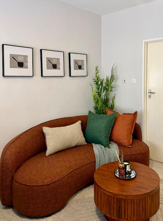
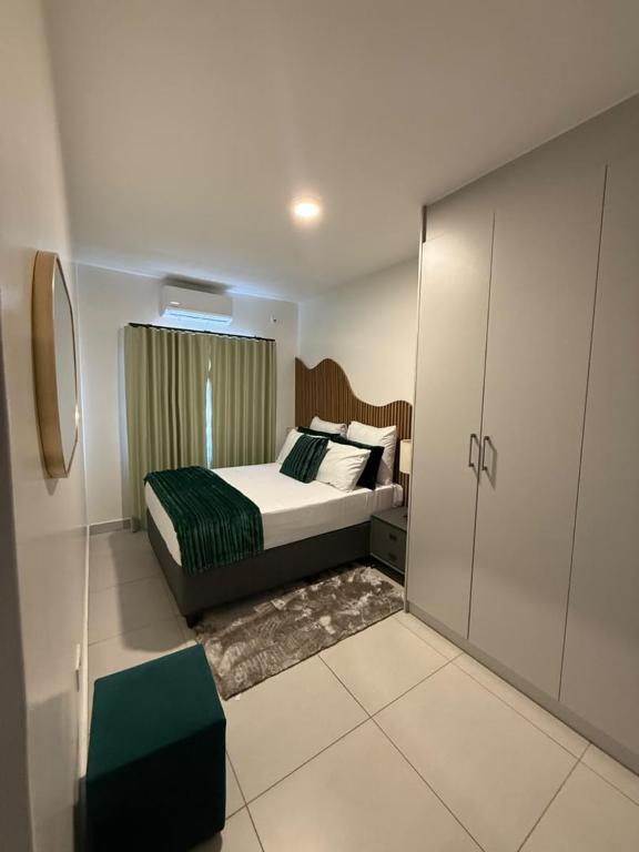
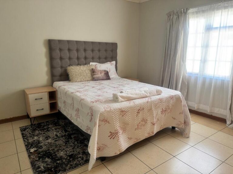
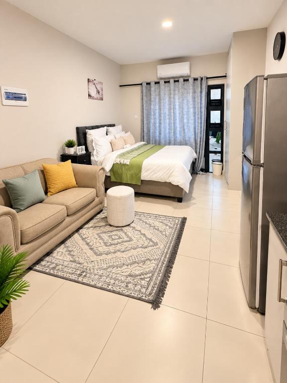
View all 357 Gaborone and the South-East propertiesAll South-East accommodation
Every card opens our own property page first. We publish no rates, no availability and no ratings of our own.
Two thirds of the bed stock here is guesthouses and bed and breakfasts on residential plots, with the business hotels in the centre.
Beds by town across the region: Gaborone, Mogoditshane, Tlokweng, Jwaneng, Kanye, Lobatse, Molepolole, Ramotswa and Mmopane.
Two archives serve this region. Accommodation in Gaborone covers the city itself — 306 properties we have checked. Accommodation across Gaborone and the South-East adds Tlokweng, Mogoditshane, Mmopane, Ramotswa, Molepolole, Kanye, Lobatse and Jwaneng, for 357 properties in total.
Sources and references
- Botswana Tourism Organisation — Gaborone
- Botswana Tourism Organisation — Lobatse
- Botswana Tourism Organisation — Kanye (Bangwaketse settlement, longest continuously occupied capital village, the Gorge, Polokwe Viewpoint, kgotla buildings and the 1894 church, Motse Lodge museum, visiting protocol)
- Botswana Tourism Organisation — Mokolodi Nature Reserve
- Botswana Tourism Organisation — Khutse Game Reserve
- Botswana Tourism Organisation — Ports of Entry
- Civil Aviation Authority of Botswana
- Air Botswana — destinations
- Government of Botswana — national park and campsite bookings
- UNESCO World Heritage Centre — Botswana
Plan the rest of your trip
South-East Botswana is where a trip starts or ends. These are the pages that decide the middle of it.
The capital in detail: arrival, orientation, what to see and where to stay.
Open →Khutse Game ReserveThe Kalahari reserve this region opens onto, 240 km from the capital.
Open →Botswana entry requirementsPassports, visas and what the three border posts actually ask for.
Open →Arriving in the south, heading north.
Most trips pass through South-East Botswana without noticing it. A day here, done deliberately, is worth more than a rushed one.
Botswana itinerariesAll regionsView all accommodation in Gaborone and the South-East — every property we have published there, each with our own write-up before any booking route.