
Nata
The junction everyone passes through, the sanctuary most people drive past, and the top of Sowa Pan.
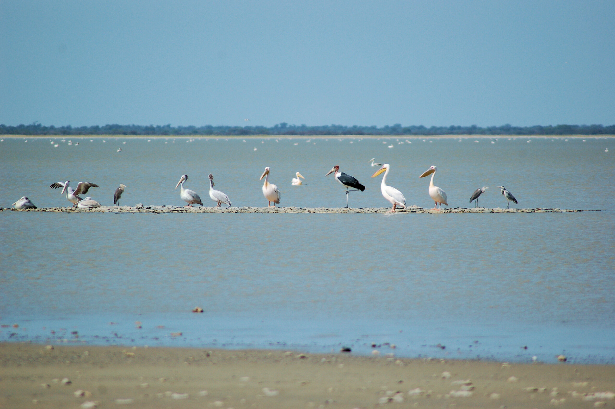
Makgadikgadi regionAll destinationsPelicans and other waterbirds on a sandbar at Nata Bird Sanctuary, Botswana, with the flooded pan behind, photographed in April. Photo: Joachim Huber, CC BY-SA 2.0, via Wikimedia Commons.
Nata is a small village that almost every Botswana itinerary passes through and almost no itinerary plans for. It sits at the junction of the two roads that carry traffic between Francistown, Maun and Kasane, which makes it the country’s most-used fuel stop. It also sits at the top of Sowa Pan, which makes it something rather more interesting than that.
- Where
- North-eastern Botswana, at the top of Sowa Pan
- Role
- Junction village and the standard fuel and food stop
- Roads
- A3 west to Maun; A3 east to Francistown; A33 north to Kazungula
- Distances
- Francistown ~180 km; Maun ~300 km; Kazungula ~300 km
- Known for
- Nata Bird Sanctuary and the Sowa Pan flamingos
- Vehicle
- Tar on all three approaches; 4×4 for the sanctuary tracks
In this guide
- Where Nata is, and why everyone passes through
- Nata Bird Sanctuary
- Sowa Pan and the flamingos
- Getting there and onward routes
- Fuel, supplies and the practical stop
- Where to stay, and how long
- Best time to visit Nata
- What Nata puts you within reach of
Where Nata is, and why everyone passes through
Nata is the junction where the A3, running west from Francistown to Maun, meets the A33 running north to Kazungula and Kasane. Francistown to Nata is roughly 180 km, Nata to Maun a further 300 km, and the A33 about 300 km north to Kazungula.
Read those three numbers together and the village’s role becomes obvious. Drive between any two of Francistown, Maun and Kasane and you pass through Nata. Drive a northern loop and you probably pass through it twice.
That is why Nata is the standard fuel and food stop on those runs, and it is why the village punches above its size. It is not a base for a week. It is the place that makes the rest of the north-east workable.
Nata Bird Sanctuary
The sanctuary is the reason to give Nata a night rather than twenty minutes. Botswana Tourism records it as covering 250 km² and as Botswana’s first community-based conservation project, opened to the public in 1993.
That founding matters. The sanctuary is community-run rather than a state protected area, which puts it in a different category from the national parks and reserves elsewhere in this region — a distinction we set out on our parks and reserves page. Revenue from visitors goes to the communities that gave up grazing land to create it.
When water fills the pans, the tourism authority describes thousands of flamingos, pelicans, ducks and geese congregating there. It also notes reasonably priced camping facilities, which makes the sanctuary one of the cheaper ways into pan country.
The sanctuary is a bird destination when the pan holds water and a wide empty view when it does not. Both are worth seeing; only one is what the photographs show.
Sowa Pan and the flamingos
Sowa, also written Sua, is the eastern of the two great Makgadikgadi pans, and Nata sits at its northern end. The Nata River is one of the rivers that feeds it, along with the Tutume, Semowane and Mosetse.
Botswana Tourism puts flamingo numbers at Sowa and the adjacent sanctuary in the tens and sometimes hundreds of thousands. It is one of the great bird spectacles in southern Africa and it is entirely conditional: the tourism authority describes the pans as filling in years of good rain and in the years that follow.
So a flamingo trip to Nata is not a season you book a year ahead. It is a condition you check before you commit. In a poor rainfall year the pan may hold nothing at all, and no amount of planning changes that. We set out the seasonal logic across the whole country on best time to visit Botswana.
Getting there and onward routes
All three approaches to Nata are tar, and all three will take an ordinary vehicle. This is one of the few places in this guide where the driving advice is genuinely simple.
West on the A3 takes you to Gweta and on to Maun, passing the turn-off for Nxai Pan National Park. East on the A3 takes you to Francistown and the Zimbabwe border. North on the A33 takes you to Kazungula, Kasane and Chobe.
What changes is what happens when you leave the tar. The tracks into the sanctuary, and everything in the pans and parks around Nata, are sand and in places black cotton. Our 4×4 and vehicle requirements page sets out what that means for the vehicle.
Fuel, supplies and the practical stop
Nata is the last dependable fuel before Nxai Pan National Park heading west, and it is the obvious top-up before the long run north to Kazungula or west to Maun. Treat it as a planning anchor: fill here whether or not you think you need to.
Fuel availability and opening times in Botswana villages change, and we do not publish either. Confirm locally, carry a reserve for the pan roads, and do not plan a leg that only works if a particular pump is open when you arrive.
Where to stay, and how long
Accommodation at Nata splits between camping at the sanctuary — which Botswana Tourism describes as reasonably priced — and lodges and guesthouses in and around the village serving the road traffic.
We publish no rates, no availability and no ratings of our own; what we can tell you is what a property is and where it sits. Start at accommodation in Botswana.
On length of stay, be honest about what you are here for. If Nata is a fuel stop, it is an hour. If you have come for the sanctuary, give it a night and a dawn: the birds are on the water early and the light on a flooded pan at sunrise is the reason people make the detour. Two nights only makes sense if the pan is full and you intend to work it properly.
Where to stay
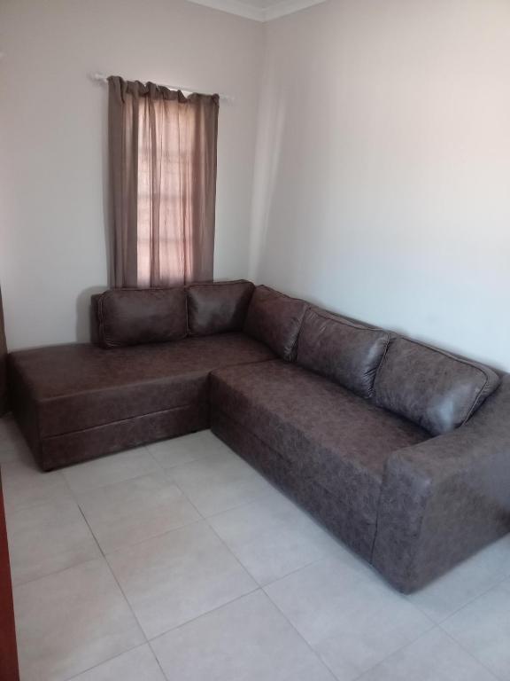
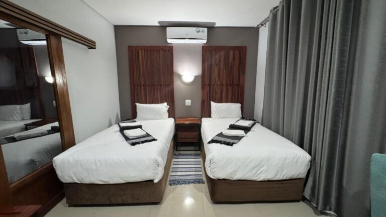
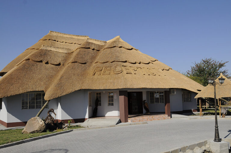
View all 11 Nata propertiesAll Makgadikgadi and Nata accommodation
Every card opens our own property page first. We publish no rates, no availability and no ratings of our own.
View all accommodation in Nata — 11 at the junction itself. For the wider region, including Gweta and Letlhakane, see accommodation across the Makgadikgadi and Nata — 20 properties we have checked.
Best time to visit Nata
Nata inverts the usual Botswana advice. The birds arrive with the water, which means the wet months, and the water depends on rain that peaks in January and February. Botswana Tourism describes the country’s rain as falling almost entirely in summer, with winter accounting for less than ten per cent of the annual total.
Summer is also the least comfortable time to be here. Shade temperatures reach 38 °C and above and occasionally 44 °C. Winter brings clear skies, cold nights and a dry pan — still a striking place, but a different one.
If you are passing through rather than visiting, the season barely matters: the tar is tar all year.
What Nata puts you within reach of
The village earns its place in an itinerary through what it is next to rather than what it contains.
Nxai Pan National Park lies west along the A3, with its entrance road leaving the tar between Nata and Gweta. Makgadikgadi Pans National Park lies further west and south, on the far side of the pan system. Chobe and Kasane are 300 km north on the A33. Francistown, and the eastern route into Zimbabwe, is 180 km east.
That is an unusually good set of options for a village of this size, and it is why we treat Nata as a destination in its own right rather than folding it into the Makgadikgadi region page, which handles the wider orientation.
Sources and references
- Botswana Tourism Organisation — Nxai Pan National Park (Nata Sanctuary: 250 km², first community-based conservation project, opened 1993, flamingos, pelicans, ducks and geese, camping)
- Botswana Tourism Organisation — Makgadikgadi and Nxai Pans (Sowa and Ntwetwe, the Nata, Tutume, Semowane and Mosetse rivers, flamingo numbers, filling in years of good rain)
- Botswana Tourism Organisation — Climate (seasons, temperatures, rainfall distribution)
Reviewed August 2026. Road distances are approximate and fuel arrangements change; if something here is out of date, tell us.
Where to stay
20 Makgadikgadi and Nata properties are written up in our catalogue. Three of them are within reach of Nata:
300 km of tar between two national parks, and where the fuel actually is.
Open →Chalets, safari tents and a campsite straight off the A3, with a fuel station on site.
Open →Painted huts and camping in a grove of seventeen baobabs beside Gweta, with meerkats and pan drives.
Open →See all 20 Makgadikgadi and Nata properties, or use the accommodation finder at the top of any page to search by property name. We publish no rates, no availability and no ratings of our own.
Plan the rest of your trip
Nata is a hinge in a route rather than a destination in itself. These are the pages either side of it.
Nata is the junction on the tar route. The alternative goes through Moremi and Savuti instead.
Open →Francistown to KasaneThe A3 and A33 north: 480 km, the fuel decision at Nata, and the elephant stretch.
Open →Nxai Pan National ParkThe nearest park, off the A3 west of Nata, on the wet-season calendar.
Open →Makgadikgadi — the regionOrientation across the whole pan system, the two great pans and the towns on the A3.
Open →Best time to visit BotswanaWhy the pans and the north peak at opposite ends of the year.
Open →Botswana 14 day itineraryThe loop that gives Nata a night instead of an hour.
Open →Give Nata a night, not an hour.
The fuel stop is the reason people stop. The sanctuary at dawn, in a year when the pan has filled, is the reason to stay.
Best time to visitAll destinationsFrancistownThe next town south on the A1, and the junction most north–south trips pass through.
Open →View all accommodation in Nata — every property we have published there, each with our own write-up before any booking route.